Categorized by region:
North
Central West
Central East
South
Showing posts with label All California Central East. Show all posts
Showing posts with label All California Central East. Show all posts
GPS Gives you Wings!
This list of GPS Coordinates of most California hot springs, even devulges water temperatures and conveniently links to topo maps for the more adventurous types ... GPS- California Hot Springs
When There's Fire & Rain in California
 FIRE WATCH June - Sept!
• Caltrans 1-800-427-7623 (road conditions)
• CALIFORNIA HAZARDS & EMERGENCY ALERTS (safety tips & alerts on wildfires, floods, mosquito viruses, etc)
• Latest California Fire Maps
• RSS FEED of Latest California Fires
Details: Unfortunately, California often has high fire danger June - September. Drought and high winds can exacerbate this issue, and fires can spread with frightening speed. Always double check local sources about road conditions and fire dangers, during this season.
Caltrans is also a good resource year round, for road conditions. Highway 1, is one of the most expensive roads to maintain in the United States, since it often sits along the ocean. The cliff defying stretch along favorite tourist destinations, such as Big Sur, is more prone than most, to have problems with falling rocks, mudslides. fog. and floods, during winter.
Native Americans and Hot Springs
Native Americans have a long relationship with hot springs.
There is evidence that many of the major hot springs in the Americas were visited and used by local native peoples. There are artifacts near some of these hot springs that support a history of human activity that extends back thousands of years. Native Americans revered hot springs as a sacred healing place.[1]
The natural hot springs in Tonopah, Arizona are a prime example. The name "Tonopah" derives from the Western Apache name Tú Nohwá, meaning "Water For Us" or "Water For You", Though there are no ruins or evidence of dwellings in the immediate vicinity of the hot springs, the prevalence of grain-grinding mortar holes, pottery shards, and other man-made objects in the area suggest that this site was frequented for many years by native peoples such as the Hohokam. The hundreds of very high quality arrowheads found near existing springs in Tonopah attest to its popularity as a hunting ground.
Reference: wikipedia
California Central East
NOTE: Always doublecheck your destination directions and information before starting your journey.
Try as we might to be accurate, our sources are sometimes incorrect.
Please let us know if there's a mistake, or another worthy hot springs that we should include, and we'll change the map!
To post non-map comments, please post to the appropriate individual hot spring.
Try as we might to be accurate, our sources are sometimes incorrect.
Please let us know if there's a mistake, or another worthy hot springs that we should include, and we'll change the map!
To post non-map comments, please post to the appropriate individual hot spring.
[The] Crab Cooker (AKA Ken's Tub)

May 2005 photos courtesy of Jenconspiracy. See more photos
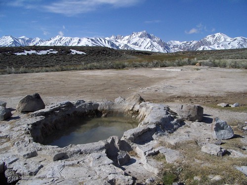
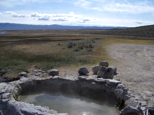
Part of the Long Valley Hot Springs, South of Mammoth. Shepherds Tub is nearby.
Furnace Creek Inn
Furnace Creek Inn
Two outdoor swimming pools, sauna
bathing suit req
fee $$$
address:Death Valley, CA 92329
how to get there: On Hwy 190, about 30 miles NW of HWY 127.
phone:619-786-2345
shelter: lodging
food: grocery store/restaurant
payment accepted: unknown
massage: unknown
Subscribe to:
Comments (Atom)
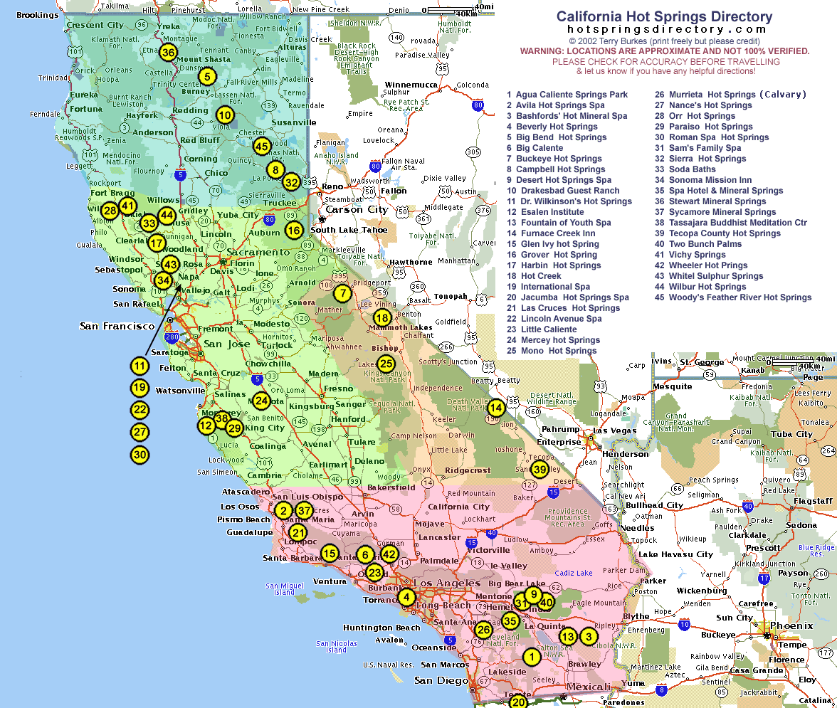 See the map
